Start: Badbury Rings car park off B3082 Wimborne-Blandford road (grid ref ST962032), Alternative start for dog-walkers, B3082 car park opposite ‘Sturminster Marshall’ turning (grid ref ST966023) and taking bridleway-track north
End: Badbury Rings car park
Country: England
County: Dorset
Type: Country
Ordnance Survey: OS Landranger 195
Difficulty: Medium
Description
Edward Griffiths discovers an Iron Age hill-fort, ancient tracks and drove roads
Badbury Rings and Sheepbriar Drove
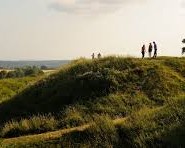
This isn’t a strenuous walk, but the ancient lanes around Badbury Rings and through the glorious farmland of Kingston Lacy Estate are filled with variety. At 327ft above sea-level, the Iron Age hill-fort has superb views all around, including Penbury Knoll hill-fort on Pentridge Hill to the north, Blandford Camp beyond Tarrant Rushton airfield in the north-west, and Charborough Parks folly tower in the south-west. On a clear day, you can see all the way to the large hotels on the cliffs of Bournemouth. Not only was Badbury Rings hill-fort occupied by Iron Age people, but by an army under Ethelwold around AD899 and by Royalist Dorset Clubmen in 1645. Sheepbriar Drove is part of an ancient route which followed the drier ground above the River Stour between Blandford Forum and Wimborne Minster, skirting around the historic Kingston Lacy estate on its way.
The Walk
1From the car park, take the path through two kissing-gates into the Badbury Rings enclosure. (Dog-walkers starting in the alternative car park, take the signed bridleway-track north and ignore Point 1 until you arrive at the junction with two benches.) Join the clear rutted track running up to your left. Its a bridleway, and you brush against the outer ring. Follow the track round to the right into the open field and join the faint grass path still skirting around the outer ring. When youve passed the OS trig point visible on the inner ring, go over the National Trust squeeze-stile by the gate near the left wood. Over into the footpath/bridleway junction, turn right to find the two benches. Turn left onto the footpath-track with the Kingston Lacy notice.
2(Dog-walkers, turn right onto the footpath-track with the Kingston Lacy notice.) Now, all together at last, follow the good track with pleasant views, ignoring any turnings into the wood. Follow the right bend when the wood ends. Continue down the footpath-track alongside the right hedge, through into a second field, for about mile in total. Around the right bend, go through the squeeze-stile by medieval Lodge Farm on the right. When you arrive at the B3082 beech avenue, go right along the wide bridleway-verge before crossing over into the signed bridleway-track with Kingston Lacys Blandford Lodge over to your left.
3Through the car park and barrier, follow the grass track around the edge of Kingston Lacys wooded park. After about mile, 200 yards after the top of the rise, turn right off the arrowed bridleways into hedged Sheepbriar Drove between high fields. Pass the left turning which runs down to Barford Farm. In another mile, go through the right half-gate onto the signed National Trust designated bridleway grass track.
4Up, over and down, there are fine views from this track, including to Badbury Rings ahead. At the bottom, zig-zag left-right and continue up to the half-gate which opens onto the B3082 beech avenue. Turn left between the new and old lines of beeches. Before the road dips down to the left Sturminster Marshall 2 turning, cross over where the visibility of oncoming traffic is best. Continue along the verge bridleway. (Here, at the car park, dog-walkers finish their walk.) Everybody else, theres another mile to go before you reach the drive back into Badbury Rings car park so enjoy the views left over the Stour Valley as you go.
Fact File
Start: Badbury Rings car park off B3082 Wimborne-Blandford road (grid ref ST962032), Alternative start for dog-walkers, B3082 car park opposite Sturminster Marshall turning (grid ref ST966023) and taking bridleway-track north
Distance: 4.12 miles (7.25 km)
Maps: OS Landranger 195
Terrain: No really difficult hills
Dogs: Under close control; not allowed in Badbury Rings enclosure
Public transport: None